


VTD-precinct 27 - ChalkButte, Meade County, South Dakota
About
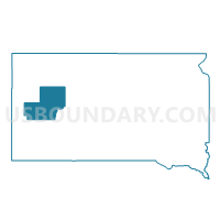
Outline

Summary
| Unique Area Identifier | 667565 |
| Name | VTD-precinct 27 - ChalkButte |
| County | Meade County |
| State | South Dakota |
| Area (square miles) | 384.93 |
| Land Area (square miles) | 384.07 |
| Water Area (square miles) | 0.86 |
| % of Land Area | 99.78 |
| % of Water Area | 0.22 |
| Latitude of the Internal Point | 44.52269670 |
| Longtitude of the Internal Point | -102.67211440 |
Maps


Graphs
Select a template below for downloading or customizing gragh for VTD-precinct 27 - ChalkButte, Meade County, South Dakota


Neighbors
Neighoring Voting District (by Name) Neighboring Voting District on the Map
- VTD - precinct 14 - Newell Ind, Butte County, SD
- VTD-precinct 17 - Viewfield, Meade County, SD
- VTD-precinct 18 - ElmSprings, Meade County, SD
- VTD-precinct 20 - Hereford, Meade County, SD
- VTD-precinct 25 - WhiteOwl, Meade County, SD
- VTD-precinct 29 - Fairpoint, Meade County, SD
- VTD-precinct 30 - RedOwl, Meade County, SD
- VTD-precinct 40 - Union, Meade County, SD
- VTD-precinct 6A - Alkali, Meade County, SD
Top 10 Neighboring County Subdivision (by Population) Neighboring County Subdivision on the Map
- Belle Fourche-Cheyenne Valleys UT, Meade County, SD (1,839)
- East Butte UT, Butte County, SD (788)
- Dakota township, Meade County, SD (29)
- Upper Red Owl township, Meade County, SD (22)
Top 10 Neighboring Unified School District (by Population) Neighboring Unified School District on the Map
Top 10 Neighboring State Legislative District Lower Chamber (by Population) Neighboring State Legislative District Lower Chamber on the Map
Top 10 Neighboring State Legislative District Upper Chamber (by Population) Neighboring State Legislative District Upper Chamber on the Map
Top 10 Neighboring 111th Congressional District (by Population) Neighboring 111th Congressional District on the Map
Top 10 Neighboring Census Tract (by Population) Neighboring Census Tract on the Map
Top 10 Neighboring 5-Digit ZIP Code Tabulation Area (by Population) Neighboring 5-Digit ZIP Code Tabulation Area on the Map
- 57785, SD (9,377)
- 57719, SD (6,217)
- 57761, SD (1,210)
- 57788, SD (485)
- 57787, SD (365)
- 57748, SD (318)
- 57791, SD (190)
- 57792, SD (129)